
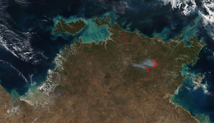
This appears to be smack in middle of Arnhem Land and although large, doesn’t appear to have been a big deal.
The NT Fire and Rescue Services hadn’t designated this as a bushfire on their current incident map. There are no media reports from the Top End indicating any bushfires.
The area is mostly unpopulated and fires during the northern dry season (May to October) are common, started by lightning or deliberately lit as a form of land management.
NASA's Suomi NPP satellite collected this natural-colour image using the VIIRS (Visible Infrared Imaging Radiometer Suite) instrument on 14 June 2019.
The Suomi NPP is a weather satellite launched in 2011 and operated by the US National Oceanic and Atmospheric Administration.
Make Space Connect a preferred news source on Google.